miércoles, 5 de noviembre de 2014

ATLANTIC OCEAN- Watching an Area

ATLANTIC OCEAN- Watching an Area With Sub-Tropical Low Potential
There's a large area of disturbed weather extending northward from the northeastern Caribbean Sea into the Atlantic Ocean for several hundred miles, as seen on this GOES-East satellite from today at 9:45 a.m. EST. That means a very soggy experience for parts of the Virgin Islands, the Dominican Republic and Puerto Rico today, who may see heavy rain.
The clouds and showers are associated with a weak surface trough (elongated area of low pressure) and an upper-level low.
The National Hurricane Center notes that a surface low pressure system could form in this area later today or tomorrow, and it could briefly acquire subtropical characteristics while moving northwestward. After that time, development is not expected while the disturbance moves north-northeastward and merges with a frontal zone.
Foto: ATLANTIC OCEAN-  Watching an Area With Sub-Tropical Low Potential
  There's a large area of disturbed weather extending northward from the northeastern Caribbean Sea into the Atlantic Ocean for several hundred miles, as seen on this GOES-East satellite from today at 9:45 a.m. EST. That means a very soggy experience for parts of the Virgin Islands, the Dominican Republic and Puerto Rico today, who may see heavy rain. 
   The clouds and showers are associated with a weak surface trough (elongated area of low pressure) and an upper-level low.  
  The National Hurricane Center notes that a surface low pressure system could form in this area later today or tomorrow, and it could briefly acquire subtropical characteristics while moving northwestward.  After that time, development is not expected while the disturbance moves north-northeastward and merges with a frontal zone.

NO. INDIAN OCEAN – System 91B

NO. INDIAN OCEAN – System 91B Has a Medium Chance for Development
The Joint Typhoon Warning Center gives System 91B a medium chance for development in the Northern Indian Ocean. It is centered near 12.8 north latitude and 87.8 east longitude, about 390 nautical miles southeast of Visakhapatnam, India.
Animated multispectral satellite imagery shows a monsoon depression with strong thunderstorms persisting along the western edge of low-level circulation center that appears to be organizing.
There are also bands of thunderstorms that have developed along the western quadrant of the storm. The system is dealing with moderate wind shear today. Maximum sustained surface winds are estimated at 25 to 30 knots (28.7 to 34.5 mph/46.3 to 55.6 kph). Minimum sea level pressure is estimated to be near 1004 millibars.
This visible image of the developing low pressure area was taken from the VIIRS instrument aboard NASA/NOAA's Suomi NPP satellite on Nov. 5 at 7:06 UTC (2:06 a.m. EST).
Foto: NO. INDIAN OCEAN – System 91B Has a Medium Chance for Development
    The Joint Typhoon Warning Center gives System 91B a medium chance for development in the Northern Indian Ocean. It is centered near 12.8 north latitude and 87.8 east longitude, about 390 nautical miles southeast of Visakhapatnam, India. 
  Animated multispectral satellite imagery shows a monsoon depression with strong thunderstorms persisting along the western edge of low-level circulation center that appears to be organizing. 
  There are also bands of thunderstorms that have developed along the western quadrant of the storm. The system is dealing with moderate wind shear today. Maximum sustained surface winds are estimated at 25 to 30 knots (28.7 to 34.5 mph/46.3 to 55.6 kph). Minimum sea level pressure is estimated to be near 1004 millibars. 
  This visible image of the developing low pressure area was taken from the VIIRS instrument aboard NASA/NOAA's Suomi NPP satellite on Nov. 5 at 7:06 UTC (2:06 a.m. EST).

GPM Satellites Analyze

EASTERN PACIFIC *Full Update* NASA's TRMM and GPM Satellites Analyze Hurricane Vance Before Landfall
TRMM and GPM revealed areas of heavy rain within the storm before it weakened to a depression and made landfall on Nov. 5. STORY/IMAGES/VIDEO:
http://www.nasa.gov/content/goddard/21e-eastern-pacific

NW PACIFIC OCEAN *Full Update* NASA

NW PACIFIC OCEAN *Full Update* NASA Sees Typhoon Nuri Pass Iwo To, Japan
Typhoon Nuri continued moving in a northeasterly direction passing the island of Iwo To, Japan when NASA's Aqua satellite passed overhead. UPDATE/IMAGE:
http://www.nasa.gov/content/goddard/nuri-western-pacific-ocean

VIDEO: Hurricane Vance

VIDEO: Hurricane Vance in 3-D from NASA/JAXA's GPM Satellite: On Nov. 3, NASA/JAXA's GPM Satellite captured data on Hurricane Vance's rainfall and cloud height that were used to create this flyover animation. Red indicates rainfall rates near 50 mm/2 inches per hour. Image Credit: NASA/JAXA/SSAI, Hal Pierce
https://www.youtube.com/watch?v=N08I-UkMPIk
(for the full update, satellite images and history of the storm, go to: http://www.nasa.gov/content/goddard/21e-eastern-pacific/)

lunes, 27 de octubre de 2014

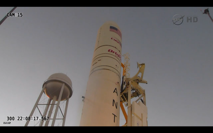
antares,,,

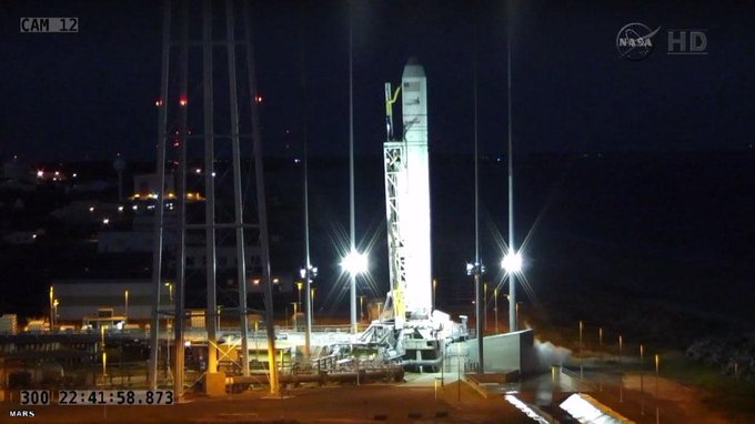
T0 target time, if able to clear range issue, is now 6:55

New launch time will be 6:55:04pm ET if we are able to clear the range for the launch tonight.

New launch time will be 6:55:04pm ET if we are able to clear the range for the launch tonight.
T-12 & counting... launch team is 'GO' pending resolution of the boat in the range for a 6:55:04pm ET

Launch count is resuming.

New Antares launch time is 6:55 p.m. Range is still red working a boat issue.

Aborting today's launch attempt due to red range safety issue  

Launch Antares rocket has been scrubbed for tonight.

We're aborting today's launch attempt of due to a boat downrange in the hazard area.

 Range is red NASA_Wallops due to boat in area. launch with craft scrubbed tonight.

View image on Twitter

40 minute antares

View image on Twitter launch countdown holding at T-12 mins due to a boat within the range area


Launch of Antares holding at T-12 minutes because of a boat in the mariner avoidance area.
 
 
launch countdown holding at T-12 mins due to a boat within the range area 40minute